Private Interests
I like:
Here is a summary of some of my travels:
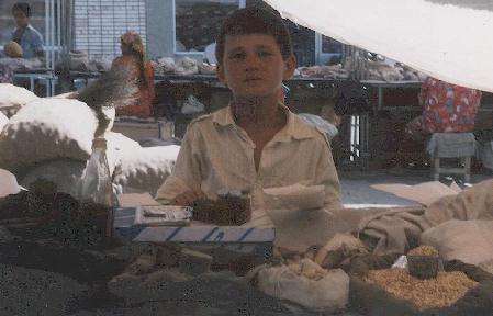
From the bazaar in Samarkand
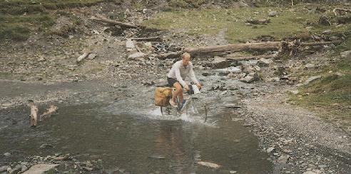
A small road in the Pyrenees.
The bicycle-trip to Spain was 6 weeks long and took me through
Germany, The Netherlands, Belgium, France, Andorra and Spain.
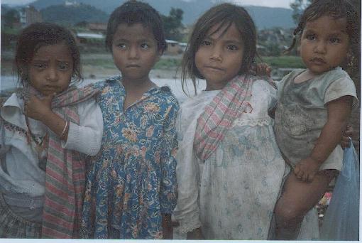
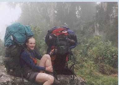
Children in Kathmandu
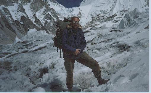
My father on the Khumbu-glacier close to Tibet (Alt. 5200m)
At this point we are on our way to Basecamp Mt.Everest, probably
the highest and most beautifully placed junk-yard in the world.
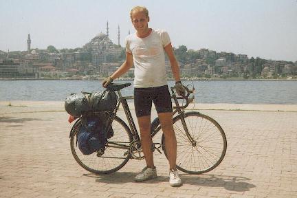
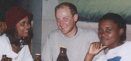
Istanbul
The bicycle-trip to Istanbul was 8 weeks long and took me through
Poland,
the former Czechoslovakia,
Hungary,
Romania,
Bulgaria,
Turkey,
Greece,
the former Yugoslavia,
Austria and
the former DDR.
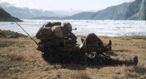
Map-check on the peninsula of Narsaaq in SW-Greenland
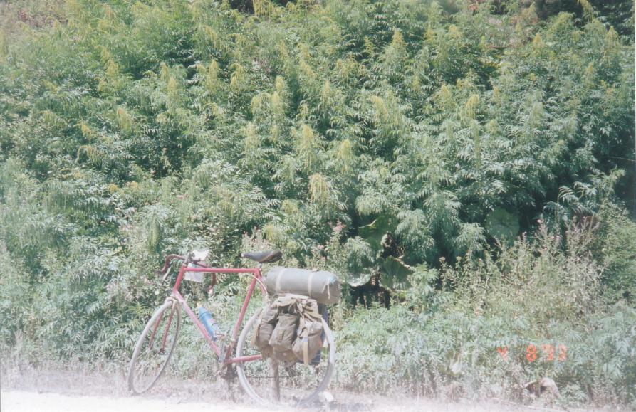
From a dusty road in central Turkey - where the weed grows as tall as a man
From a trek round the volcano of Villarica in Chile
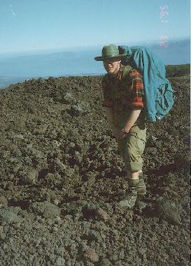
Mount Kenya Summit 1995
Trek in the National Park of Mount Kenya.
A diary of the climb of Mount Kenya done in July '95 by
Lars Kr. Lundin & Claus Bendtsen.
Feel free to use any of the following information, but don't be
sure that it is correct or in any sense useful.
From Nairobi to Nyeri (2/7):
Some hours with a matatu.
Found info on matatus in 'Lonely planets' - 'East-Africa'.
From Nyeri to Park gate (3/7):
A rather muddy dirt road app. 15km, not suitable for walking or
normal cars/buses. Paid 20USD for someone to drive us there in a 4WD.
Park Entry (Alt. app. 2400m):
Day fee 12USD, night fee 8USD - with some sort of student discount.
The number of day-fees to be paid must be number of night fees + 1,
hence an odd amount of money must be presented in cash either in USD or
Kenyan shilling, no mixing of currencies possible.
We only had 10USD-bills and they had no change - would not give change
in Kenyan shilling, would not keep change. So we waited some time
(occurs frequently in East-Africa) before someone came and sold us
two 2USD-bills.
From Park gate to end of road at Met station (Alt app. 3100m) (3/7):
No porters or guide required, and we did not use any - rucksacks app.35kg.
10-15km dirt road suitable for walking.
Can be done with 4WD.
We walked to acclimatize ourselves.
We camped 200m further than the end of the road, and
found water somewhere to the left of the general direction of moving.
Began eating diamox.
Had problems with our ceramic water filter, but did get enough to
drink in spite of diamox. Our back-up water-cleaning, namely iodine,
had by accident been packed in the rucksack of a friend not joining us
in this part of the trip.
From end of road to BC beneath Diamond col (4-5/7):
After crossing the wood-line (2-3 km's from the end of the road)
the passability of the terrain decreased significantly - patches of
long grass and a thin and very slippery layer of black mud in between.
Hard to keep balance (because of rucksacks), tirering.
Not much water.
After some (5-8?) km's the ground gets dry (alt. app. 3800),
and easy to walk. And it became easier to find nice looking water.
Due to the filter problem and the diamox I decided to drink some
uncleaned water and had no problem with that.
We were all the time letting the other know about nausea, head-aches,
etc., and whenever there was some, we took breaks till we felt OK.
My symptom felt like wearing a too small steel helmet.
We camped at app. 4000m a few hundred meters from a manned
stone-building where we were offered accommodation (for some payment).
The walk on the dry ground was quite nice, lot's of different mountain
animals and a nice view towards Batian & Nelion. After a few km's we
came to some sort of post for park wardens - some stone buildings.
We informed them of our plans, and told them that we expected to be
back in 3 days.
At around 4200m the path got steep and rocky, but still OK to walk.
At around 4600m a rocky plateau was reached, when looking ahead (and upwards)
one sees the impressive Diamond col. BC was established in a shelter
called something like 'Thomsons bivi', found to the right on the
plateau. It has room for two + gear & cooking. Water was found 100m
away in a small lake in the direction of the glacier-line. Spent the
afternoon relaxing, preparing the climbing gear, plus doing a bit of
climbing on the lowest part of the glacier.
From BC to Ice-window (6/7):
We got up early in the morning (the first part of the glacier could be
climbed easily in darkness) using no belay. Dawn broke as we reached the
end of the first glacier part. Set up belay there and traversed left into
the hidden col and set up belay there. A very nice climb up through
the hidden col - app. 5 m's are really steep. Rock and ice felt good.
Good sitting belays on the rocky sides. Reached the end of the
col and traversed 10m left just underneath the roof of the Diamond
glacier to a small plateau - app. 60cm X 3.5m. As we had a break
there it began to snow - it poured out over the edge of the Diamond
glacier, so we were glad to sit sheltered below the overhang. When it
stopped snowing it was so late, that we decided to camp there
(alt. 5000m). As the sky cleared and the sun went down the view was
absolutely awesome. We melted snow for water (the MSR-stove worked really
nice despite of the height, unlike other stoves I have tried), ate and
went to sleep on our inflatable bedrolls in our sleeping-bags +
goretex bivi-bags. Little or no feeling of nausea & head-aches.
From Ice window to summits (7/7):
Early in the morning we climbed the Diamond glacier - held a bit to
the right as to be able to belay on the rock. As we reached the Gates
of mist we were no longer in the shadow and it became quite warm. We
took off our crampons (as there was no more ice & snow), and left the
day-packs on the Bation side of the Gates. When climbing Batian we did
at first not traverse far enough and ended up in some rather
unpleasant rock. We turned back and traversed across some rock that
did not look to good, and found the col leading towards the summit.
As it often happens it was cloudy when we got there, but we still felt
good about it. We took some pictures and went back to the day-packs at
the gates. As it was still early in the day we climbed Nelion as well.
From there we overlooked the entire National Park and took some more
pictures. The shelter up there was OK, it had some mattresses. It was
quite low, but could accommodate several people.
No feeling of nausea & head-aches.
From summit to BC (7/7):
We abseiled down the same way as we had climbed up, with the exception
that we abseiled directly from the overhang of the Diamond glacier
into the hidden col. It took somewhat longer than we expected, and the
descent from lower part of the hidden col to the BC was done in
darkness. We reached BC after 40 hours on the mountain. We were a bit
dehydrated, quite exhausted, but felt OK. Since we were low on cash we
had to be out of the Park the end of the following day, otherwise we
would have to pay an extra park fees, not leaving us enough money to
get us from the park gate to Nyeri. So we packed our things and
started walking back.
From BC to Park gate (8/7):
The walking was somewhat difficult in the darkness, and my buddy fell
now and then. I had kept my plastic boots on, and it made things
somewhat easier for me. At around two we found the post and contacted
the wardens. We were exhausted and accepted an invitation to sleep on
some mattresses inside their house. At six in the morning we got up,
and by then we were asked for some dollars for the accommodation. This
was unexpected (had we not been so tired when arriving, we would have
realized that their hospitality was offered in the expectation of
some payment). We ate some cold high-energy food and went on. By now I
wore normal boots and when crossing the slippery mud-covered ground it
was my turn to take some falls. When we reached the wood-line my
trousers were muddy to the knees. At noon we arrived at the met station,
where we met a park-warden that agreed to take us to the park gate for
a price we could afford. He was apparently not supposed to make money
this way, because he dropped us off a few hundred meters from the
park gate.
As we reached it we were approached by a (white) man who had seen
our rucksacks. He asked us some very qualified questions about
the climbing, and surprisingly he went away and came back with a large
photograph showing the Diamond glacier and the hidden col. It turned out
that he was the chief warden (his name is Bongo Woodley). He told us
that there normally is a rather large overhang at the beginning of the
Diamond glacier, and that climbers therefore make a hole through the
ice as to reach the upside of the glacier. Hence the name of the
route. He also told us that there to his knowledge not had been
anybody else on that route for a month. He was surprised that we
descended down the same route, especially because somebody (austrians?)
had inserted bolts with rings every 25m down an easier rock-route
(I can't remember its name). It would however had been a long walk
from the end of that route to our BC. The chief warden had a man going
to Nyeri (in fact the same man that we had paid to take us from the met
station to the park gate), and he offered us a free ride with this car.
We accepted gladly and departed.
The local tribes were found to be very friendly
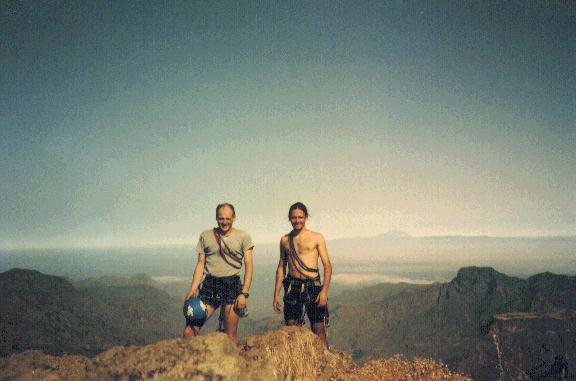
On the top of Roque Nublo with Tenerife in the horizon.
This trip was actually a summerschool - with room for some excursions.
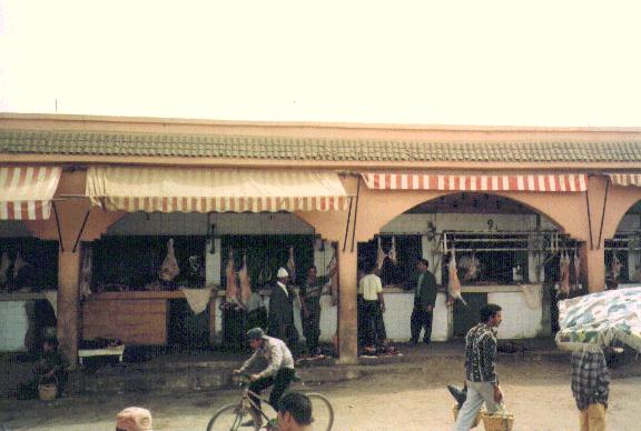
Small-town meat market in Northern Marocco.
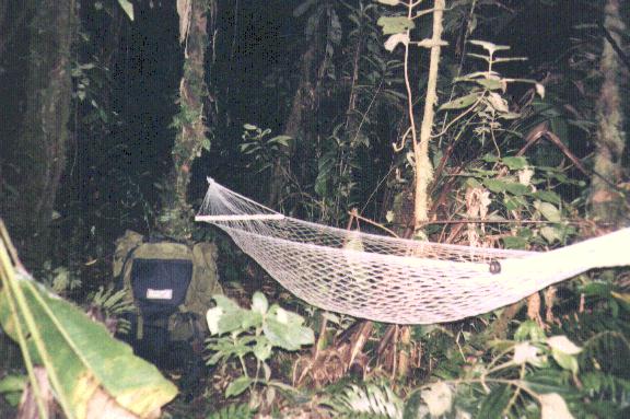
Setting up camp in the wilderness of 'La Amistad'.
Completed by stringing a poncho up above the hammock.
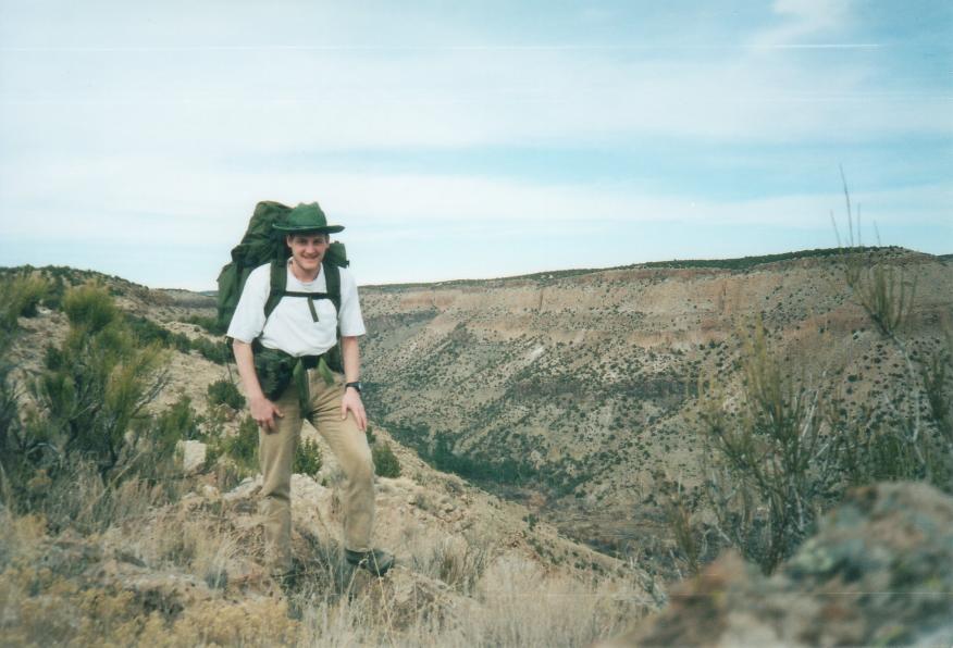
The backcountry of 'Bandelier National Park'.
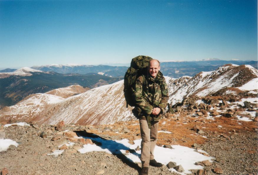
Between 'Wheelers Peak' and 'Bear Lake'.
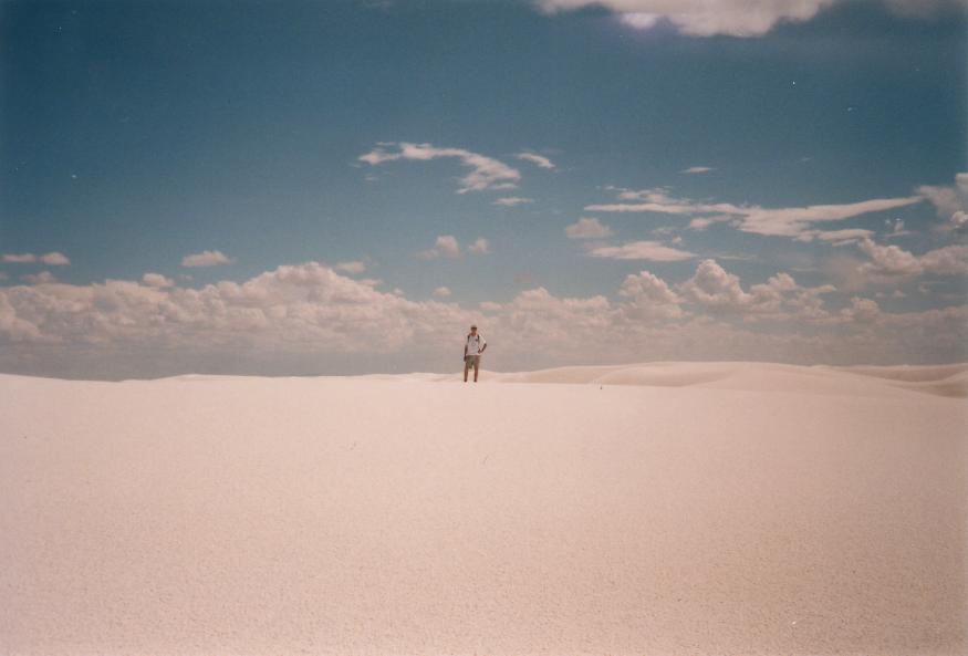
With Menno in White Sands - a great place to test the GPS
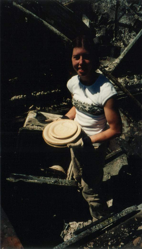
Christine is emptying her dish washer
- after the Cerro Grande Fire
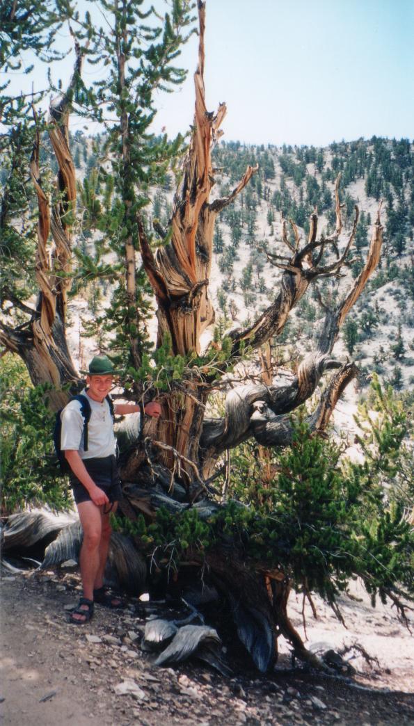
Bristlecone in California - The oldest living organism on this planet is a Bristlecone in this "forest".
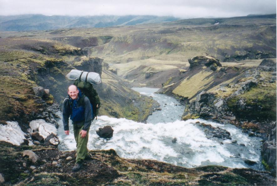
Trekking in Iceland.

Hiking in December with Sten to Rösssjön, Sweden.
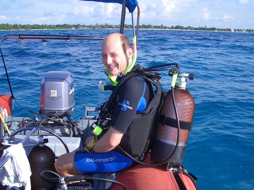
Preparing for a wreck dive.
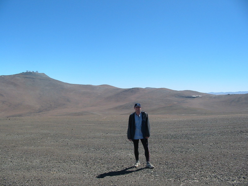
A hike below the ESO Residencia and Cerro Paranal with its four 8m telescopes in the Atacama desert.
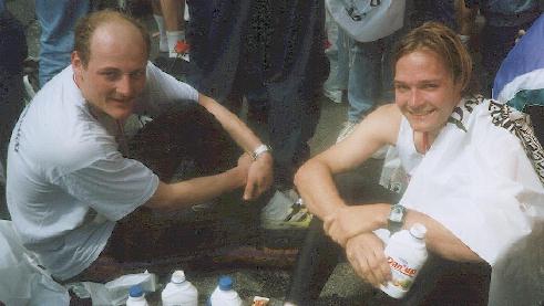
Claus and I are
relaxing after our fourth Wonderful Copenhagen Marathon
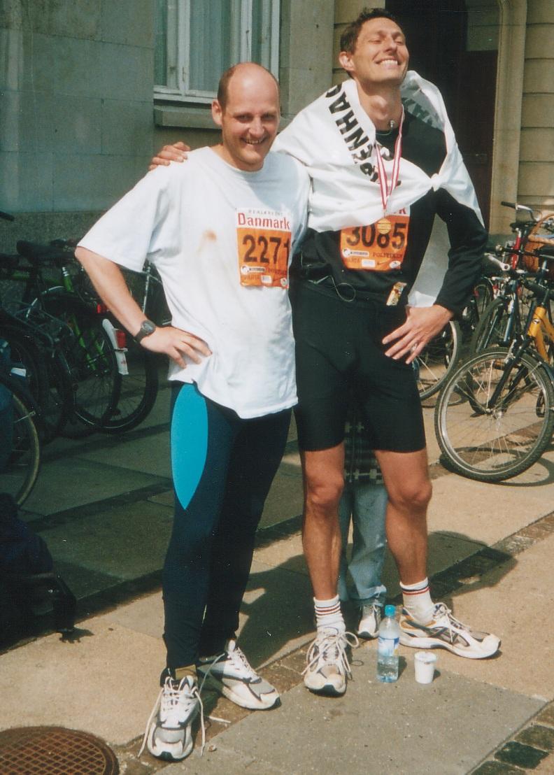
John and I are relaxing after our Wonderful Copenhagen Marathon of 2003
I like both cross-country and down-hill skiing
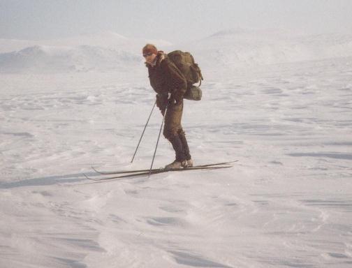
Kungsleden (Lappland) in April
Completely off-piste somewhere in Austria
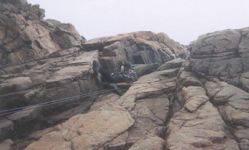
Belaying just below the crux at 'Svenskerruten' at Kullaberg.


